


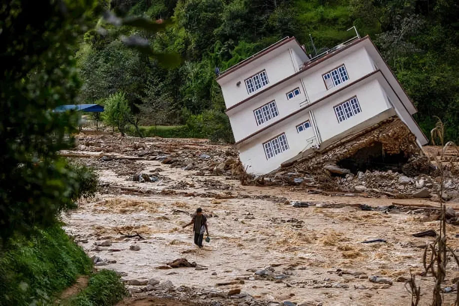
On 27 September 2024, the Roshi River, Kavrepalanchowk, rose faster than anyone could react to. Debris flowed off the surrounding hillslopes, exacerbated by mining and river encroachment, turning the heavy monsoon downpour into one of the deadliest flood events in Nepal's recent history. Over 20 people died, 500 houses were destroyed, and 713 were partially damaged in a matter of hours (Shrestha, 2024). Everything disappeared under the sediment and water.
Now, imagine a better version. A sensor upstream detected the rising river level. A signal is transmitted downstream, and a siren alerts the villagers. People have 30 minutes to an hour to move their families, livestock, and documents to higher ground before the water arrives. The flood still happens, but the number of names on the casualty list decreases.
That gap between the flood that occurred and the one that could have been avoided with adequate warning is exactly what a community-based early warning system (CBEWS) is designed to address.
What a CBEWS Actually Is
A CBEWS is a combination of technology and a human network designed to identify a hazard before it occurs and relay that information to the people in its path with sufficient time to act. Rather than relying solely on a distant, centralized system, CBEWS is a "community-based" system that puts local people at the center, enabling them to work alongside official forecasting bodies (DHM & Practical Action, n.d.) .
The CBEWS rests on four connected pillars without which the system tends to fall apart.
Risk knowledge comes first, whether through historical data, local memory, or technical risk mapping, to know which areas flood first, how quickly the water level rises, and who is most at risk.
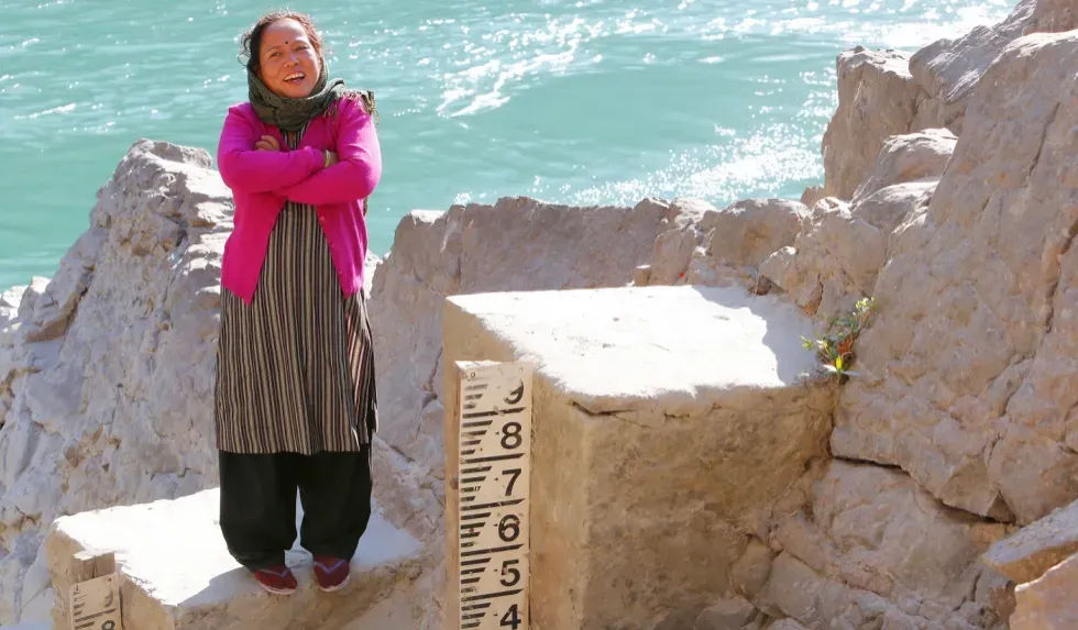
Monitoring and detection entail at least one person or object, typically both, who are always watching: a volunteer monitoring a marked gauge or automatic sensors reporting to a regional forecasting center.
Communication and dissemination ensure that detection reaches people in time, be it through sirens, text messaging, radio, or door-to-door volunteers, so that the warning reaches households without phones or signal.
And response capability turns warnings into action: a practiced evacuation plan with clear responsibilities for checking on elderly or disabled neighbors so that a warning doesn't turn into confusion (Sresthacharan & Mall, 2017).
The fact that people feel more inclined to act on information from their trusted neighbor than on a random text message, particularly in the middle of the night, is one reason the community-based approach is more effective than a purely top-down broadcast system. This is especially true where there is poor infrastructure or highly localized terrain and in many areas where two villages are a few kilometers apart, which can face different risks.
How Nepal Built This, River by River
Nepal's early warning system was not developed from a single national plan. It was built, river by river, often in the wake of disaster, and the new one learned from the previous one.
It began in 2002 on the East Rapti River in Chitwan, where communities used a machan, a raised platform originally built to spot wildlife crossing the river, which was later used by rotating volunteers to watch the river level. This model was implemented throughout the flood-prone Terai regions of Nepal, along the Narayani, West Rapti, Babai, Karnali, and Mohana rivers, between 2006 and 2010, in partnership with the Department of Hydrology and Meteorology (DHM), Practical Action, and the Nepal Red Cross Society (DHM & Practical Action, n.d.).
Some systems were built before disaster struck. Others came after. DHM installed sensors on the Seti River in 2013, following a glacial flood the year before that killed several people in Pokhara without any warning, the same lack of warning that would cost the Roshi Valley so dearly in 2024 (PreventionWeb, 2021). The Kankai system, built in 2014, further incorporated rain gauge readings from mountain catchments and river gauging stations, taking into consideration that floods not only occur due to rainfall at nearby points but also due to activities further upstream (PreventionWeb, 2021). But hardware was never really the problem. In Madhesh province, thirteen municipalities along the Lal Bakaiya River did something quieter and harder: they signed an agreement to fund their own system's maintenance. That one decision solved what has killed more early warning systems than any flood—the moment external funding runs out and no one is left to answer the phone (ICIMOD, 2025).
DHM now covers communities across roughly eight major river systems—the Karnali, West Rapti, Babai, East Rapti, Narayani, Bagmati, Kankai, and Koshi (DHM & Practical Action, n.d.). The technology ranges from a volunteer on a wooden platform to telemetric sensors and SMS alerts. The gap between those two things is wide. But the principle underneath them is the same: someone has to watch, someone has to warn, and when the alarm sounds, the community has to already know what to do.
Where Roshi Stands Now
The Roshi River isn't on that list of eight. After the September 2024 floods, Smartphones4Water Nepal started building a real-time hydrological data baseline for the basin by installing automated weather stations, engaging local citizen scientists, and mapping vulnerability and exposure as groundwork for an eventual warning system (Smartphones4Water Nepal, 2025). It's careful and unglamorous work, gauge by gauge, data point by data point, constructing the risk knowledge pillar before anything can be constructed on top of it.
The Roshi did not have a CBEWS in September 2024, so it is not possible to say how many lives one would have saved that night. But the pattern across every river system where Nepal has installed one tells its own story. A clear illustration can be found in the 2014 monsoon flood, in which the Karnali and Rapti basins, both covered by CBEWSs, received early warnings, and a response was carried out. But in Babai Basin, due to the destruction of the monitoring station by the flood, people were deprived of warnings, and lives were lost simply because of the presence or absence of a working system (Sresthacharan & Mall, 2017). The mechanism is not complicated: the water rises, the alert goes out, and people move. What is currently being done in Kavrepalanchok is, in essence, a way to ensure that if the river level rises again, someone is there to watch and that this time, the watch actually reaches the people downstream (Smartphones4Water Nepal, 2025).
References
Department of Hydrology and Meteorology, Government of Nepal, in collaboration with Practical Action. (n.d.). Flood early warning system in practice: Experiences of Nepal. Climate Technology Centre & Network. https://www.ctc-n.org/sites/default/files/resources/flood-early-warning-systems-in-practice.pdf
ICIMOD. (2025, February 10). In southern Nepal, 13 municipalities unite to fund Community-Based Flood Early Warning System. ICIMOD Blog. https://blog.icimod.org/cryosphere-water-risks/flood-early-warning-terai-2024/
PreventionWeb. (2021, August 2). Community-centred flood early warning system in Nepal. https://www.preventionweb.net/news/community-centred-flood-early-warning-system-nepal
Shrestha, J. (2024, October 1). Roshi river flood devastation in Panauti. The Kathmandu Post. https://kathmandupost.com/visual-stories/2024/10/01/roshi-river-flood-devastates-panauti
Smartphones4Water Nepal. (2025, August 31). From disaster to preparedness: Closing the flood data gap in the Roshi River Basin. https://smartphones4water.org/from-disaster-to-preparedness-closing-the-flood-data-gap-in-the-roshi-river-basin/
Sresthacharan, S., & Mall, R. K. (2017). Community-based early warning systems for flood risk mitigation in Nepal. Natural Hazards and Earth System Sciences, 17, 423–437. https://nhess.copernicus.org/articles/17/423/2017/nhess-17-423-2017.pdf
Practical Action. (2010). Practitioners handbook for establishing community-based early warning systems. Practical Action.